Translated with AI


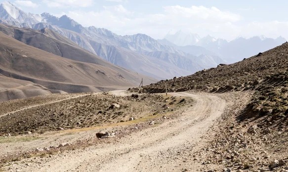
On July 16, 1935, the first ever Komsomol scientific expedition to the Pamirs started, which went down in history as the Tajik-Pamir expedition. It was attended by 31 separate detachments, uniting 105 scientific workers. It became the most important event in the study of the region's natural resources and made a significant contribution to the development of geological sciences in Central Asia, the press service of the CIS Executive Committee reports.
The expedition involved 105 researchers, including geologists, collectors and engineers. According to the direction of work, the groups were divided into search (9), exploration (5), geological survey (14) and technical and economic (3). The main goal of the expedition was a comprehensive scientific study of the Pamirs, an assessment of its natural resources and a study of the possibility of using them for the purposes of socialist construction.
The expedition conducted a geological survey and as a result compiled an almost continuous ten-verst map of the south-eastern part of Central Asia. The participants studied igneous rocks, the features of their occurrence, and also conducted test mining of ore in individual areas to assess the possibility of its profitable exploitation. These methods became an innovation in the practice of geological exploration of that time.
The work was carried out in extremely difficult conditions: the lack of detailed maps of the area, difficult routes, river floods from melting glaciers, rocky cliffs and the danger of rockfalls significantly complicated the movement of the detachments, especially in the mountainous terrain and harsh Pamir climate.
Despite all the difficulties, the expedition successfully completed its tasks. Within its framework, the Western Pamirs, the upper reaches of the Zeravshan Valley and the central part of the Gissar Range were explored. The participants also determined the routes of future excursions of the International Geological Congress: from Aulieat through the Tien Shan passes to Namangan, along the Fergana Valley and in the Pamirs – between Lake Karakul and Murghab.
According to the assessment of the Geological Group of the USSR Academy of Sciences, the results of the Tajik-Pamir expedition of 1935 significantly advanced the understanding of the geological structure, petrology and geochemistry of Central Asia and became the basis for subsequent geological research in the territory of Tajikistan.