Translated with AI


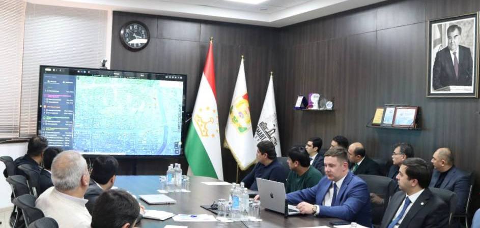
A new design for the "Electronic Map of Dushanbe" project, featuring an analytical module and update functionality, was unveiled in Tajikistan's capital. The project presentation took place on January 22 at the initiative of the Dushanbe City Executive Authority and was organized by the Smart City State Unitary Enterprise. This was reported by NIAT Khovar, citing the Smart City State Unitary Enterprise.
The presentation showcased the project's key functional capabilities, presented samples of the geoportal and analytical reports, and explained the project's implementation stages and the role of each institution in its practical implementation.
The "Electronic Map of Dushanbe" project was developed based on the instructions of Dushanbe Mayor Rustami Emomali and is being implemented by the Smart City State Unitary Enterprise of the Dushanbe City Executive Authority in collaboration with GS Era Limited Liability Company. As part of the project, Dushanbe's territory will be mapped using unmanned aerial vehicles and converted into digital format.
An electronic map is a cartographic image created from digital map data. It includes information on geodetic points, terrain, hydrography, vegetation, soils, economic and cultural assets, road networks, utilities, urban infrastructure elements, boundaries, and other terrain features.