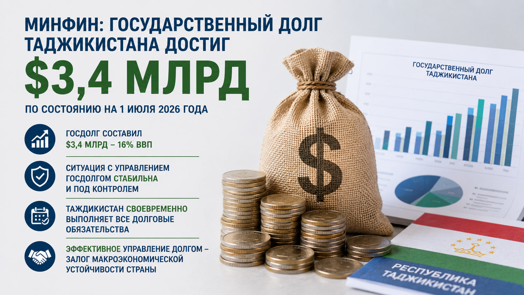
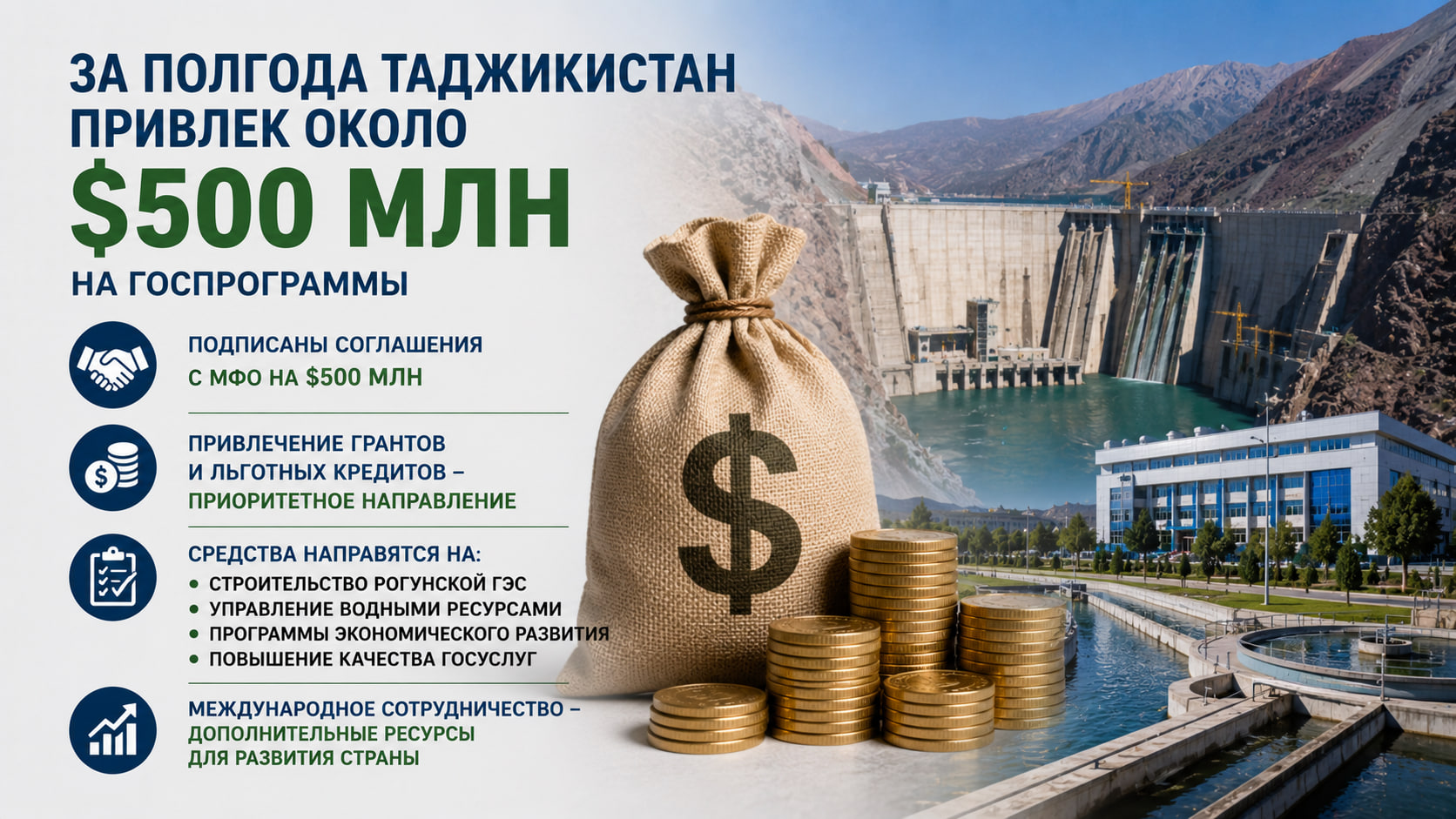
Translated with AI
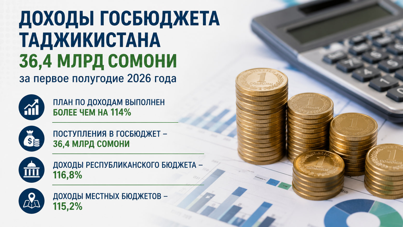


Specialists from the Tajikistan Hydrometeorology Agency, the Glacier Research Center of the National Academy of Sciences of Tajikistan, and the Russian Academy of Sciences have implemented a new method for glacier monitoring using ground-penetrating radar equipment combined with aerial imaging. The Agency reported this.
According to the Agency, the purpose of using the georadar method is to obtain more accurate data on the thickness and density of glaciers, which is necessary for long-term forecasting of their dynamics and assessment of water resources.
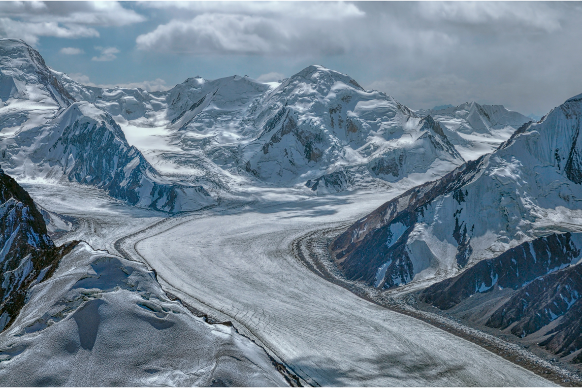
It is noted that the research was conducted for the first time using ground-penetrating radar on a helicopter platform. This approach made it possible to survey hard-to-reach and high-altitude sections of glaciers, where ground-based measurements are difficult or impossible.
During the expedition, photographs were also taken of glaciers and high-mountain lakes in the Gorno-Badakhshan Autonomous Region of Tajikistan, which will allow new materials to be added to national databases and atlases.
Preliminary results confirm the high efficiency of the method and its potential for systematic monitoring of the state of glaciers and water bodies in Tajikistan.