Translated with AI


The southern part of the Kamchatka Peninsula shifted almost two meters to the southeast after a powerful earthquake, Interfax reports, citing the Kamchatka branch of the Unified Geophysical Service (UGS) of the Russian Academy of Sciences.
"We conducted a preliminary calculation based on the results of geodynamic observations. It turned out that we all moved quite well to the southeast. The maximum coseismic displacements after the July 30th earthquake were observed in the southern part of the peninsula. There, they amounted to almost 2 meters, which is comparable to the horizontal displacements after the 2011 earthquake in Tohoku, Japan," the report states.
According to the EGS branch, the Petropavlovsk cluster of stations and Petropavlovsk-Kamchatsky itself, accordingly, "shifted somewhat more modestly."
"This pattern of displacements is consistent with the preliminary model of movement in the source, where the maximum was reached on the southern flank of our enormous source, which ensured a full-fledged macroseismic effect in Severo-Kurilsk, and an insufficiently full-fledged one in Petropavlovsk-Kamchatsky," the seismologists note.
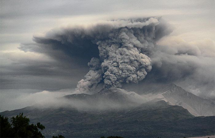
On the morning of July 30, a powerful earthquake struck near Kamchatka, the strongest since 1952. Its magnitude reached 8.8. The intensity of the tremors in various parts of the peninsula ranged from magnitude 6 to 7 and higher. A tsunami alert was issued. This earthquake, measuring up to magnitude 8, was also felt in Severo-Kurilsk, followed by four tsunami waves that partially damaged port infrastructure and other industrial facilities.